20 - Monuments, Navajo, and Arches

Monument Valley
Upon leaving the Grand Canyon with Bruce in’78, my
journal made passing reference to our surroundings:
Drove
through desert, some intense flatlands, with jagged rock rising
mysteriously.
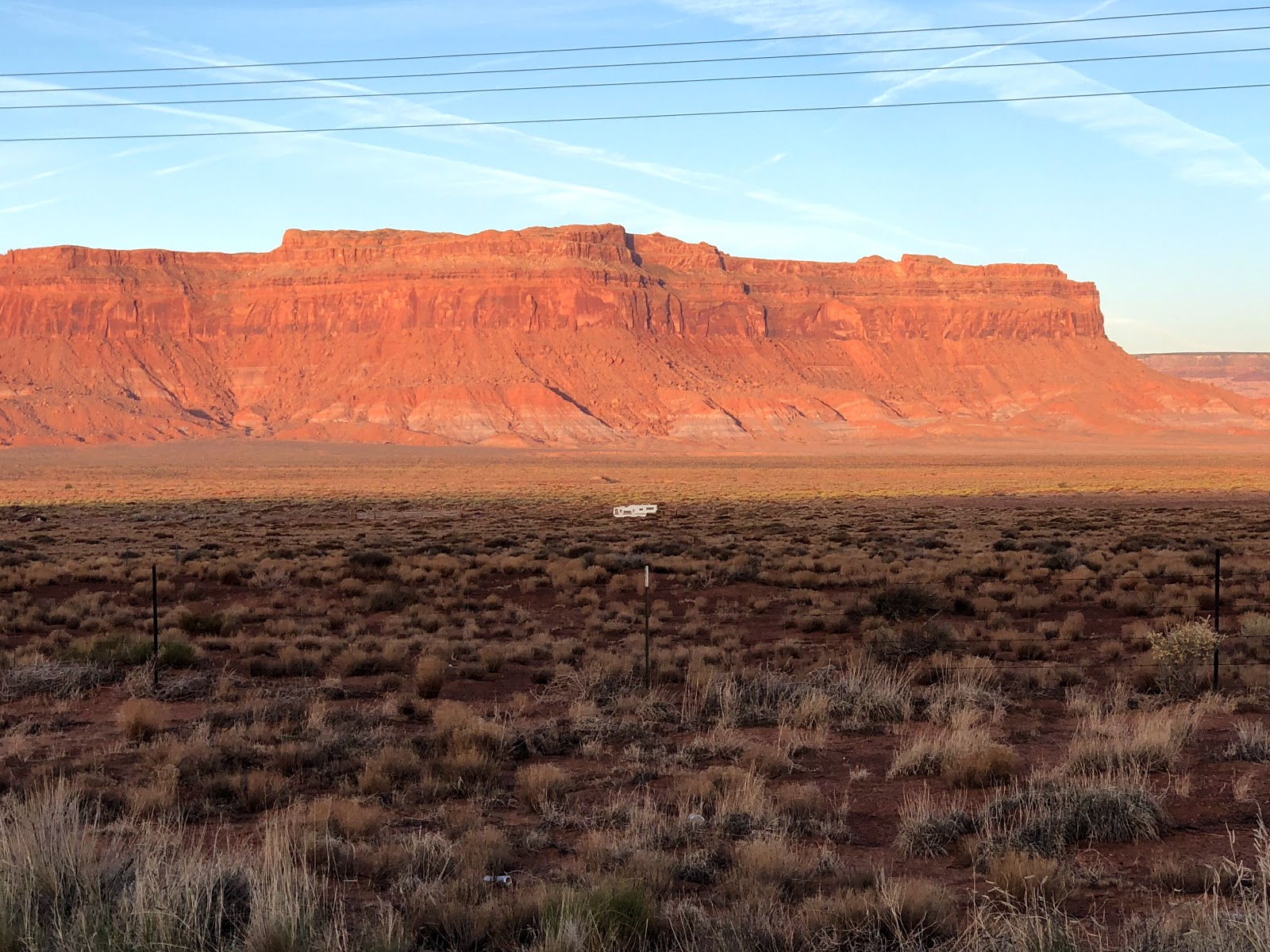
This stretch of northern Arizona to
southeastern Utah. featuring sandstone buttes as tall as 1000 feet, is called
“Monument Valley.” It has been used as a location film for so many movies, that
it defines what many people imagine when they think of the old West.
Photos from 1978:

Photos from 1978:


And from 2018, starting at sunrise:


 |
| Mindblowing juxtaposition of rock styles! |
Much of this area sits in Navajo Nation, and it is common to see vast expanses of land against breathtaking backdrops, on which sits a wooden shack or a small camper.
Many Navajo sell jewelry and other
items along the road side, also in rustic wooden structures that may or may not
be attended.[1]


Arches National Park
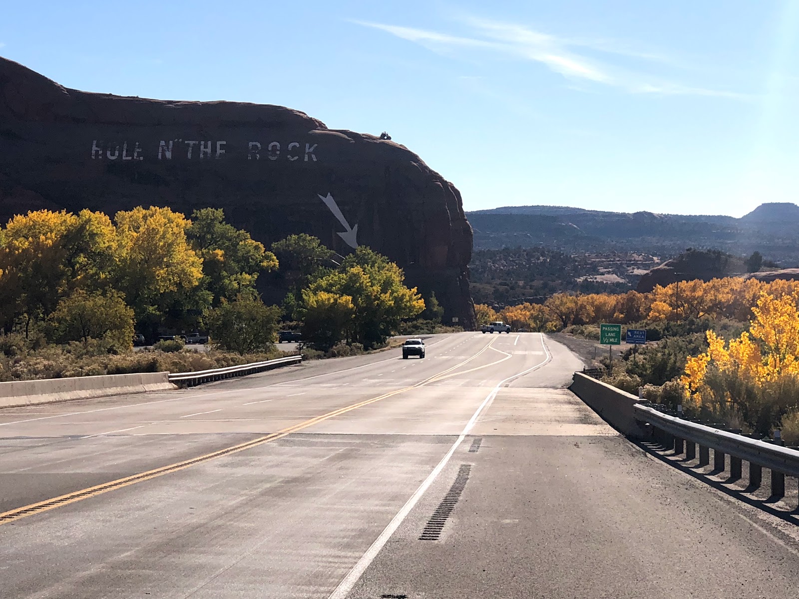
In 1978, after driving through Monument
Valley, Bruce and I stopped in a small town in southeastern Utah, so named for
this sombrero-shaped rock outcropping on the edge of town:

We
stopped in a Mexican Hat bar to play pool, then drove north. I slept in the car
while W drove, originally planning to drive all night and see a sunrise. But
the tape deck punked out, and when we stopped at a fast-food restaurant in
Moab, we decided to camp out in Arches National Park. The owner of the
restaurant told us it was cool, though his pretty blonde young employee said it
was nice “only if you like red.” He (the owner) gave us maps and route
information, and we drove off into the park. We camped in Devil’s Garden on a
soft bed of sand, among the sandstone rocks and low bushes, and fell fast
asleep on a cold, cloudy night.
Slept
late and checked out Arches on a cloudy day. Took a short hike to Landscape
Arch, 291 feet and seemingly ready to collapse. Numerous cool rock formations
and forming arches.
There are so many amazing parks in
southern Utah that Bruce and I missed, so I am grateful to that fast food
restaurant owner for telling us about Arches, or we may have driven past that
one as well. Inexplicably, either Bruce did not take photos there, or they are
lost. Here are some from other sources, including my 2018 visit:
 |
| Landscape Arch |
 |
| Three Gossips (near center, just left of the road) |
 |
| Windows Arches |
 |
| Double Arch |
 |
| Balanced Rock |
 |
| Delicate Arch, with me dressed like a kindergartner |
 |
| Celebrating a hike with a beverage. |
Author Edward Abbey spent two years in the late 1950’s as a park employee at Arches, residing in a “little tin government house trailer” near what is now Balanced Rock. His book “Desert Solitaire,” which a friend graciously gave me in advance of my trip, is a fascinating read for those who want a glimpse of a far less developed America, and what was then called Arches National Monument.
Abbey described Balanced Rock as
“3500 tons of seamless Entrada sandstone perched on a ridiculous, inadequate
pedestal of the Carmel formation, soft and rotten stone eaten away by the wind,
deformed by the weight above.” He predicted that “One of these days that rock
is going to fall – in ten, fifty, or five hundred years.” He also surmised that
Delicate Arch would “soon disintegrate into a chaos of falling rock.” Both are still
standing, although a much smaller outcropping near Balanced Rock, named
“Chip Off the Old Block,” collapsed in the winter of 1975-1976. Landscape Arch also remains strong, despite my 1978 doubts.
A fierce environmentalist, Abbey
railed against what he called “industrial tourism” and the proposal to install
paved roads and other development at Arches. He called for banning cars,
demanding that tourists be made to walk, ride horses, or use bicycles.
He brushed off foreseen criticism:
“What about children? What about the aged and infirm? Frankly, we need waste
little sympathy on these two pressure groups. Children too small to ride
bicycles and too heavy to be borne on their parents’ backs need only wait a few
years … the aged merit even less sympathy: after all they had the opportunity
to see the country when it was still relatively unspoiled.” (Abbey then
relented slightly from his own position, allowing the possibility of shuttle
buses for the “old” and “sickly.”)
Colorado
Bruce and I drove east from Arches,
encountering cliffs, more sandstone and flatlands with low scrub, and then - as
we entered Colorado - mountains with gold trees and rivers adding to the
landscape. But this is what we chose to photograph instead:


We sometimes played a game to see how long we could keep the car in neutral until its speed dipped below 30 MPH: Kept cruising over the mountains – 11.4 mile coast from a 12,000 foot peak.


We sometimes played a game to see how long we could keep the car in neutral until its speed dipped below 30 MPH: Kept cruising over the mountains – 11.4 mile coast from a 12,000 foot peak.
I paid more photographic attention to the transformation of landscape in my 2018 redux:


And arrived in Colorado, on my way to revisit beloved Boulder.


Next: Boulder, Colorado – are we here to
stay?
[1] After an excellent lunch, I wrote a little about Navajo history, against the backdrop of the development
of Navajo fry bread to supplant their traditional reliance on agriculture,
here: (url coming soon)
 |
| Pork Chile Verde with Navajo Fry Bread |
Photo credits: Mexican Hat, Landscape Arch, and Windows Arches from Wikipedia; all others from Bruce in 1978 or myself in 2018.


Comments
Post a Comment